General News
1 January, 2023
Saviour and villain
SUMMER READINGMOST of us probably take the Loddon River for granted as we pass through the area in which this paper is distributed. Today, we will start to take a quick trip down the Loddon River, the second longest river in Victoria, flowing from...
SUMMER READING
MOST of us probably take the Loddon River for granted as we pass through the area in which this paper is distributed.
Today, we will start to take a quick trip down the Loddon River, the second longest river in Victoria, flowing from the Great Dividing Range in the south to the Little Murray river in the north.
In all the river is joined by 19 minor tributaries, it descends 567 metres (1860 feet) over its 392 (244 miles) course.
The following major creeks all flow into the Loddon River: Middleton, Fryers, Tarilta, Campbells, Jim Crow, Muckleford, Mia Mia, Sandy, Joyces, Boundary Gully, Tullaroop, Bet Bet, Jones’s, Bradford, Back (at Newbridge), Bul a bul, Hope, Sangus, Pyramid, Barr, whilst there are two important anabranches - Serpentine and Kinypanial creeks.
There are a number of other smaller creeks and gullies that run into the river during wet times.
The river is or could be crossed by the Daylesford-Malmsbury road at Glenlyon; Walls lane, Swords road, the Drummond-Vaughan road crosses the river at two locations, Hopkins lane.
The next crossing was the Tarilta road bridge (now closed) thus now a shallow ford, Kemps Bridge road, the Midland Highway at Guildford, the Maryborough - Castlemaine railway line, Punt (now Barkla) road and the Pyrenees Highway in Newstead, what is now Cairn Curran reservoir wall, Baringhup road, Hamilton’s crossing, a popular camping spot on the Baringhup West - Eastville road, Pickerings lane, Rumbolds road, Back Eddington Road and Bendigo-Maryborough road at Eddington.
There was Janevale bridge, a reinforced concrete girder bridge built in 1911, at Laanecoorie, the Wimmera highway at Newbridge, Willies road (an old Cobb & Co. crossing place), Calder Highway, Bridgewater, the Eaglehawk-Inglewood railway line, Bridgewater-Serpentine road, Lagoona road, Borung-Hurstwood road, unnamed, Majors Line road, Ellerslie Road, Boort-Pyramid road, Boort-Yando road, Canary Island-Leaghur road.
And further north, Redgum road, Appin South road, Hewitt-Wren Road and Wood lane, Old Kerang road, Murray Valley highway at Kerang, the Yungera, Bendigo-Swan Hill) railway line, Weir road, O’Donoghues Bridge road, Baulch road and finally Benjeroop-Lake Charm road.
The river rises down around Bullarto, not too distant from where the Coliban river rises. It flows through the Wombat forest on past the village of Glenlyon there not being anything of significance until just north of Glenlyon where the stream passes over the tessellated pavement (volcanic lava flow) before the water cascades for about 15 metres.
To visit the Loddon Falls you need to take Holcombe road, turn left into the dry weather only Sewells road. Park at the gate and then walk along the track until you come to a sign.
You then walk down hill to the cliff face from where you can see the waterfall and the hexagonal basalt columns. Care must be taken as there are no safety barriers.
Further downstream there is Dyers Falls scenic reserve, this being off the continuation of Holcombe road and Swords road. This reserve is very difficult to access, the rock formation not being so spectacular.
The river next flows mostly through bushlands until it gets to Glenluce where one can find a mineral water spring, off the Drummond - Vaughan road.
Whilst the track is narrow and often full of pot holes a visit can be rewarding just to look at the rock formations.
A walk upstream, along Dry Diggings track towards the old Central Springs picnic ground, from the Vaughan Springs picnic ground will reward you with a spectacular view from the cliff top.
Once again care is needed.
At Vaughan Springs there is a concrete embankment across the river, built around 1930, that makes a popular swimming hole, a gas barbecue tables etc and a massive slide for the young at heart. If you have never been to Vaughan Springs do yourself a favour and go take a geek. Make sure you check out the old closed off Tarilta road bridge.
The river then flows down under Kemps Bridge into a gully lined with poplar trees. These make a picturesque sight at Autumn if you care to drive up the gravel road to the lookout tower in Havelock street, Guildford.
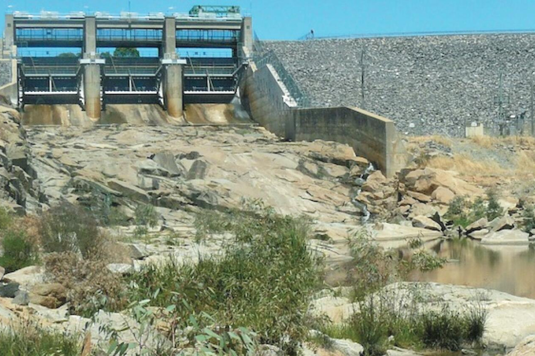
There is little to see until one gets to the Cairn Curran reservoir, construction starting in 1946, costing £1,231,000, the wall to be 2200 feet, 104 feet above the river bed. The wall was completed in 1956. Here you will find a nice picnic ground.
The flooding of this weir necessitated the realignment of the Midland Highway and the Maryborough-Castlemaine railway line where Joyces Creek enters the catchment area.
At the low level Hamilton’s crossing on the Baringhup West-Eastville road, you will see the remains of the old road bridge and if you are lucky a platypus or two. This crossing is a popular camping area however there are no facilities.
The Back Eddington road crossing consists of three low-level bridges thus it is often refered to as Three Bridges. The remains of the old bridge can be seen.
A little upstream from the Bendigo-Maryborough road bridge, built in 1929 to replace the old bridge in McCoy Street, Eddington, the Tullaroop Creek merges with the river whilst a short distance downstream you will find the remains of a nice old bridge over the Bet Bet Creek on what was once the Carisbrook to Tarnagulla road, it becoming a casualty when the Laanecoorie weir was filled.
Incidentally 1053 acres of land was purchased so that the Laanecoorie weir could be built - cost around £65,000, also recorded as £85,568 plus £48,308 spent to purchase the land.
Work started in the later 1880s but the on going floods caused problems.
NEXT WEEK: PART TWO