General News
9 January, 2023
Growlers and relic
SUMMER READINGBy KEN ARNOLDWHEN Chas. E. Randell was town clerk of the Borough of Tarnagulla, tenders were for called for the construction of 46½ (more or less) of storm water channel. Mr. A. Keogh was successful in winning that 1872 tender at...
SUMMER READING
By KEN ARNOLD
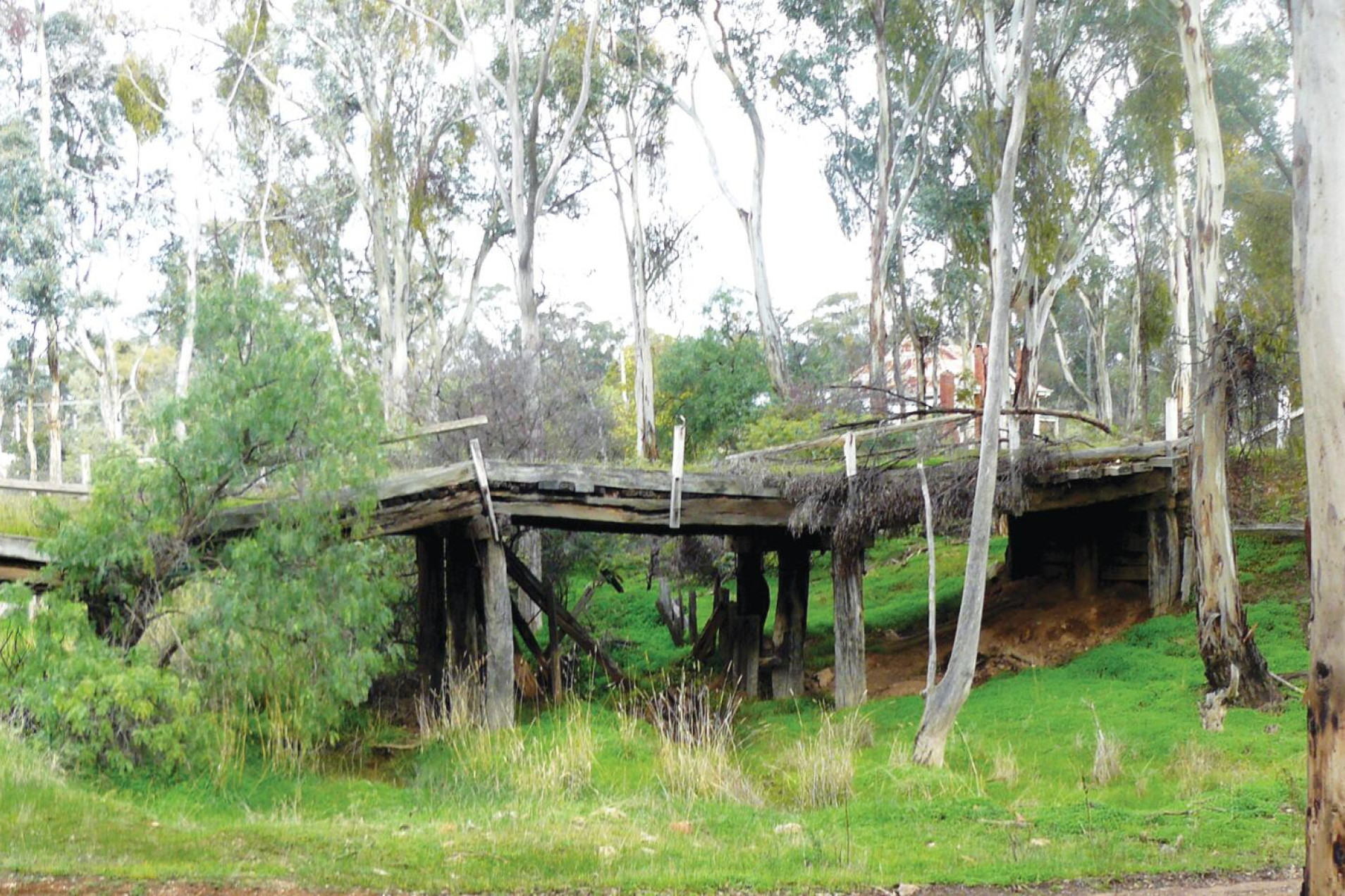
WHEN Chas. E. Randell was town clerk of the Borough of Tarnagulla, tenders were for called for the construction of 46½ (more or less) of storm water channel.
Mr. A. Keogh was successful in winning that 1872 tender at £1500/0/0. It was intended to carry the water from the lead at the southern end of Tarnagulla with a pitched culvert, with substantial bridges at intervals from around Wayman Street down to Welsh Street.
The storm water then flowed under Welsh Street onwards through land that has been subjected to mining.
The Sandy Creek is next joined by a small creek that catches the water from the Growlers Hill mining area. Flowing onwards the water passes under the railway line, built 1888, under the bridge in Lytton Street as this was once the main Bendigo to St Arnaud road until more recent times, then on behind the rail station through land that has been dredged onwards past the cemetery where it is joined by another small creek.
The creek becomes nothing much more than a flood plain until it passes the Hard Hills diggings on under Tarnagulla road where it runs into a man made channel down to the Bul a Bul Creek.
This channel was once lined with vertical logs backed by redgum slabs however little remains of this relic which runs alongside the Rheola-Llanelly road down to the Bul a Bul Creek at Irishtown.
Although the Bul a Bul Creek was sometimes refered to as Sandy Creek I have generally not refered to the latter after its point of outlet at Irishtown bridge, Murphy’s Creek.
The Orville Creek is fed by water from the slopes of Mount Moliagul. The water runs down under O’Briens drive, near the old cemetery, then under the Wedderburn-Dunolly road at McIntyre, down through the paddocks under the Dunolly -Orville road before crossing the Rheola -Llanelly road near Quiripel lane.
This creek is joined by another unnamed creek that rises near the old gold rush village of Orville which crosses the Rheola-Llanelly road then on under McDonalds road before joining the Kangderaar Creek.
The Kangderaar creek rises in the old gold rush town of Rheola, formerly Berlin /Berlyn, area it wending its way under the Wedderburn-Dunolly road on through the granite outcrops until it meets the Orville Creek. The water then passes over the McIntyre - Inglewood road then under Allens road before it joins a small stream that flows down from around Reeces Lane.
The water next passes under the Llanelly-Arnold West road onwards over Simpson Creek Lane until it joins with the Simpson Creek, just off the Rheola-Arnold road at Arnold West, onwards until it meets the Bul a Bul Creek.
The Kangderaar creek was in flood in February 1880.
An unnamed creek roughly follows the Arnold West road from around Allens road down over the Llanelly - Arnold West road before merging with Simpson creek which runs from Corr’s corner over the McIntyre-Inglewood road, down over the Kingower-Arnold road, on under McCamish and Arnold West roads before it joins the above unnamed stream.
The Simpson Creek then runs under the Rheola-Arnold road on under the Simpson Creek lane around to the Kangderaar Creek.
The floodwaters east of the Arnold West-Inglewood flow down from what is known as Cranes down past Schores Pitt Road or down past Mioline Road over the Dunolly-Inglewood road on towards the Bul a Bul Creek near the old Bul a Bul railway station.
Neither the Dead Log or Magpie Creeks have anything of significant interest however on the north bank of the Bul a Bul Creek, near the Dunolly-Rheola road, there was once a small pile of rocks, this marking the burial site of a woman and her children, they having died from the result of poisoning from drinking the water from the creek, it being contaminated by eucalyptus from the gum leaves.