General News
6 January, 2024
Extras resources in town ahead of predicted third dump
THE State Emergency Service will base an incident centre in Wedderburn from 1pm Sunday as the district prepares for a massive rain dump over the next 48 hours. Hundreds of sandbags were filled today in Wedderburn and Korong Vale by CFA and community...
THE State Emergency Service will base an incident centre in Wedderburn from 1pm Sunday as the district prepares for a massive rain dump over the next 48 hours.
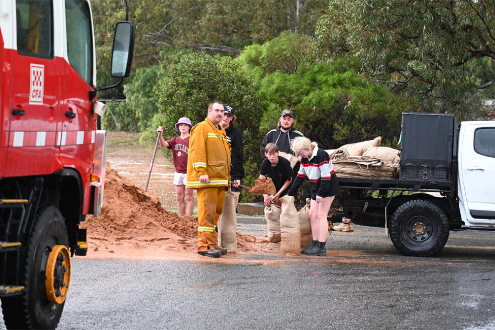
Hundreds of sandbags were filled today in Wedderburn and Korong Vale by CFA and community volunteersand the SES has deployed specialist crews from Melbourne to Wedderburn ahead of what is forecast to be the area's big rainfall in less than a fortnight.
Additional SES crews will be based in Bendigo ready to be sent to areas that may be impacted by flash flooding.
Sandbag stations at Wedderburn's Jacka Park and outside Korong Vale fire station will re-open at 8am Sunday morning. Households are limited to 25 sandbags.
A flood watch has been issued for the Loddon River of widespread minor flooding and isolated moderate flooding from Monday morning in parts of the watch area.
The advice issued this afternoon says: "An embedded low pressure system is forecast to develop over far western Victoria on Sunday evening and will move over central districts during Monday. This will bring widespread rainfall in the Flood Watch area and is likely to cause minor flooding, with isolated moderate flooding from Monday morning. Catchments are moderately wet following recent rainfall.
"Widespread rainfall totals of 30 to 60 mm are likely in the western and central region catchments of Flood Watch area on Sunday into Monday. Isolated totals of 60-80 mm are possible due to heavy falls from thunder storms. Widespread rainfall totals of 60 to 100 mm are likely across north central and north eastern catchments of the Flood Watch area from late Sunday into Monday.
"Isolated totals over 100 mm are possible due to heavy falls from thunderstorms. Showers are expected to gradually contract to the east of the state during Tuesday. River level rises and widespread minor flooding with isolated moderate flooding is likely to develop from Monday morning for parts of the Flood Watch catchments."
State Emergency Service chief officer Tim Wiebusch told a media conference today that the rain was set to start on Sunday afternoon or evening and continue through Monday, with flash flooding possible — particularly in northern areasof the state.
And there are warnings for campers too.Mr Wiebusch said people camping along rivers and streams needed to be prepared to relocate as soon as heavy rain started.“Don’t wait for warnings,” he said.
SES Loddon operations manager Brad Dalgleish said the severe weather warning included strong winds, hail and rain.
Police and the SES have again urged people not to drive through floodwaters. There were multiple rescues around Wedderburn on Tuesday night including one local man, 60, whose vehicle was lifted and propelled 500 metres down the Nardoo Creek.
The Wedderburn and Korong Vale areas have already had more than 300mm of rain since Christmas Eve with flooding damaged houses, destroying and estimated 300km of fencing and left farmers counting stock losses
The Loddon Herald will provide regular on-the-ground updates throughout Sunday.